

Melrose Terrace floodplain restoration
- Client Name
- Brattleboro Housing Partnership
- Location
- Brattleboro, Vermont, USA
This project received a 2024 Merit Award for Engineering Excellence from the American Council of Engineering Companies of Vermont (ACEC-VT)
Challenge
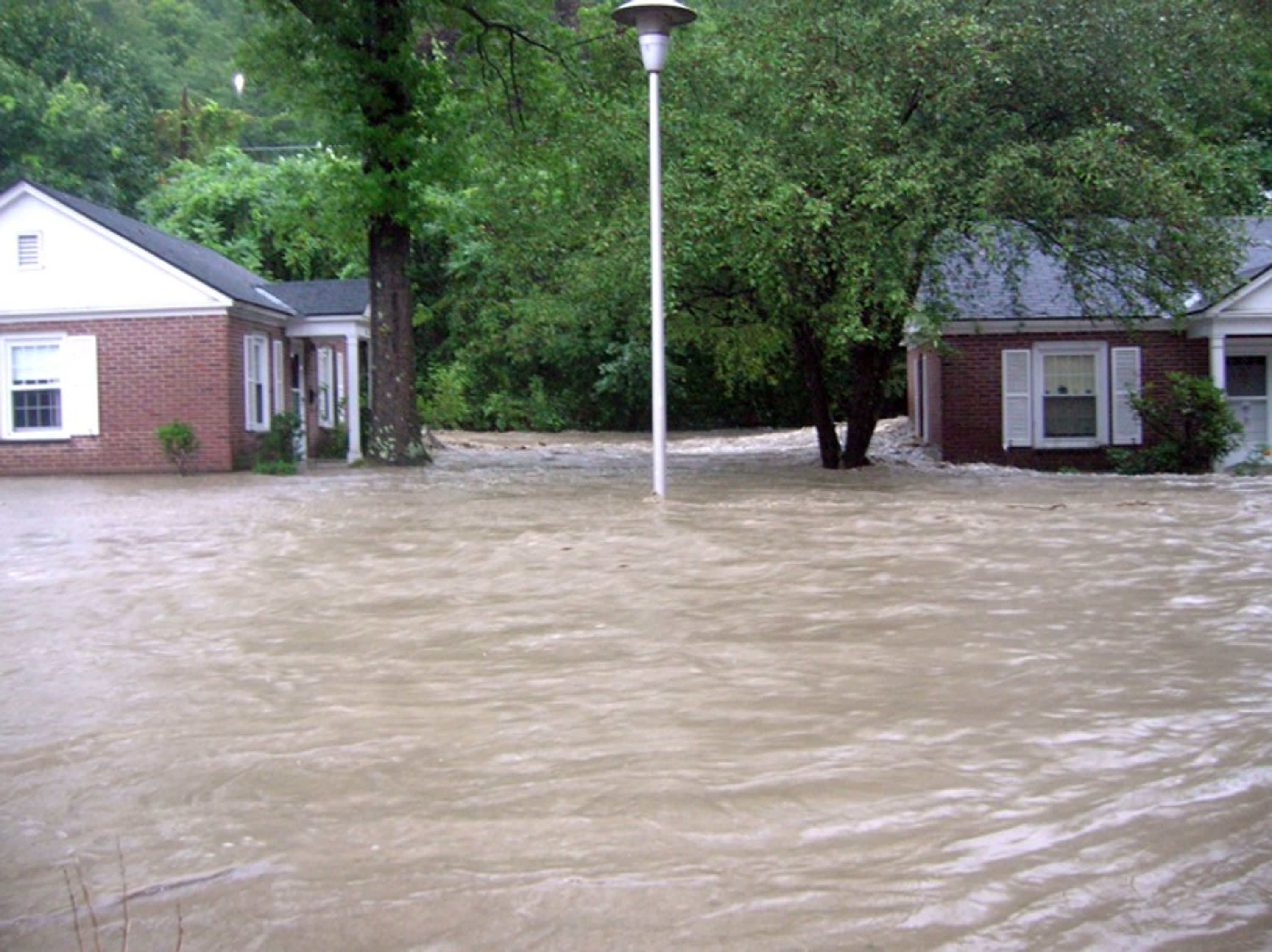
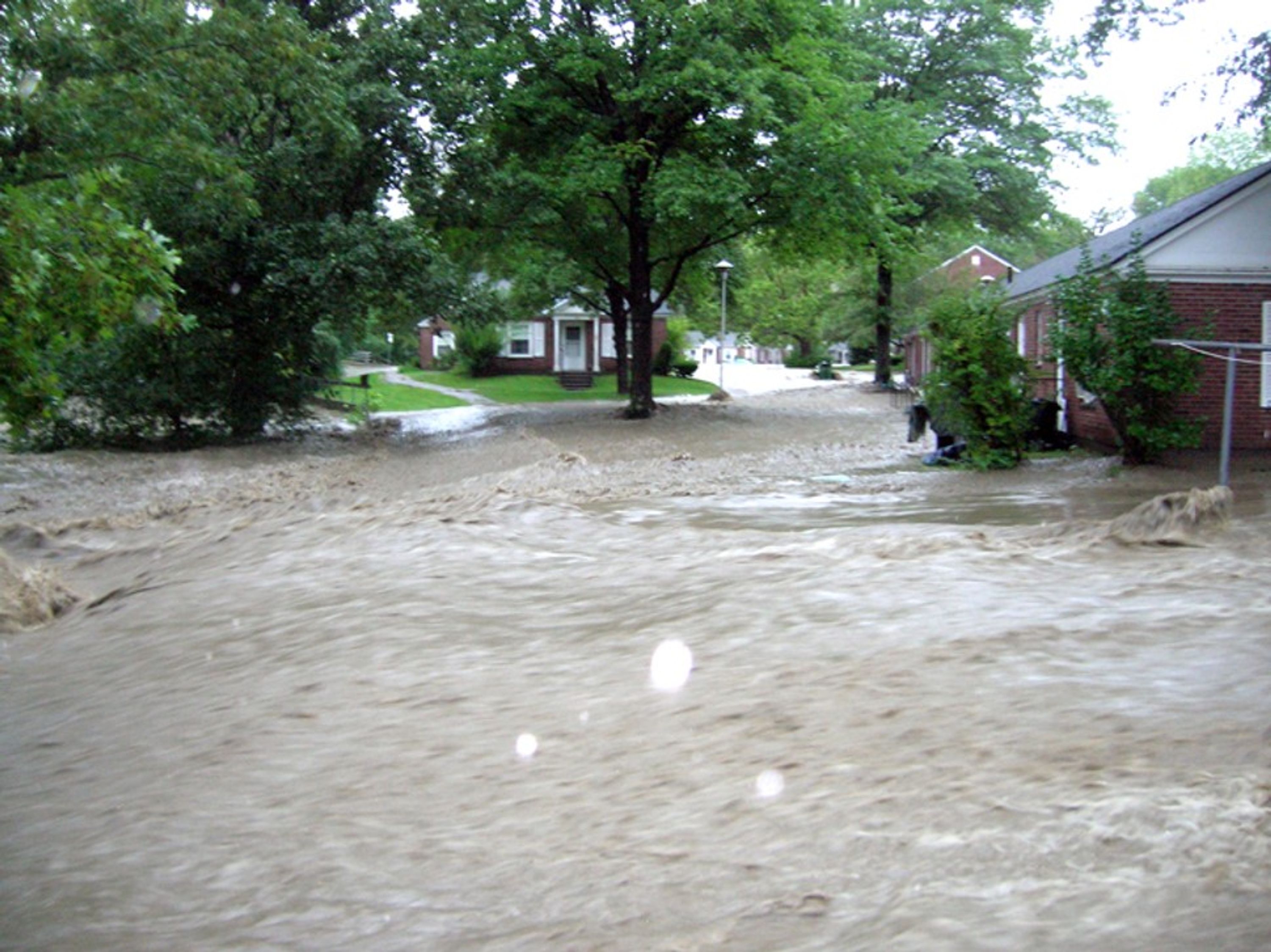
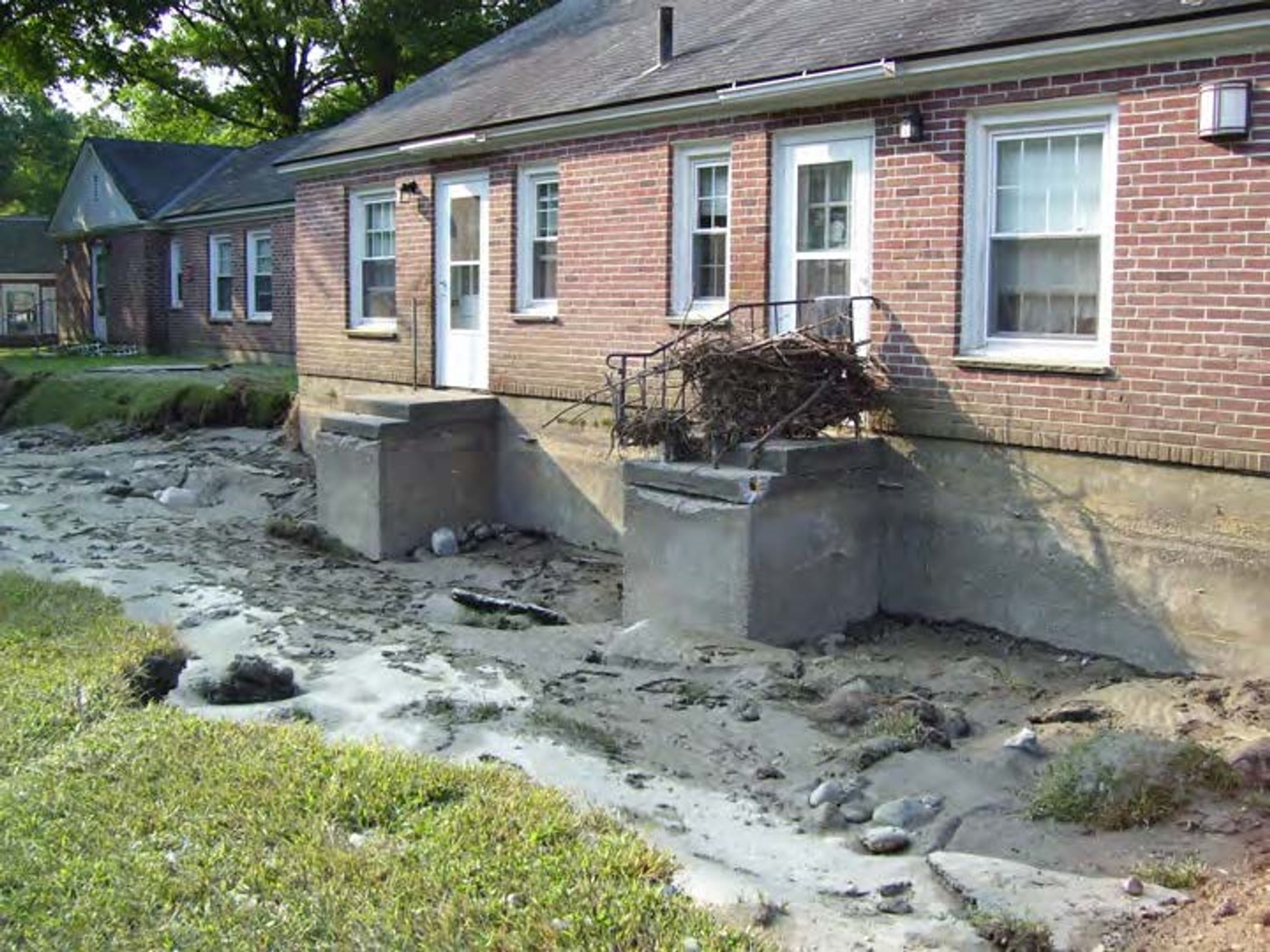
Melrose Terrace was built in 1965 and was comprised of 80 units found in 16 buildings across an 8-acre parcel in Brattleboro, VT. This parcel sat on the banks of the Whetstone Brook and was prone to flooding. When Tropical Storm Irene impacted the entire state of Vermont in August 2011, sixty of the eighty apartments were damaged in the storm and residents were evacuated for safety.
Damage to Melrose Terrace after Tropical Storm Irene
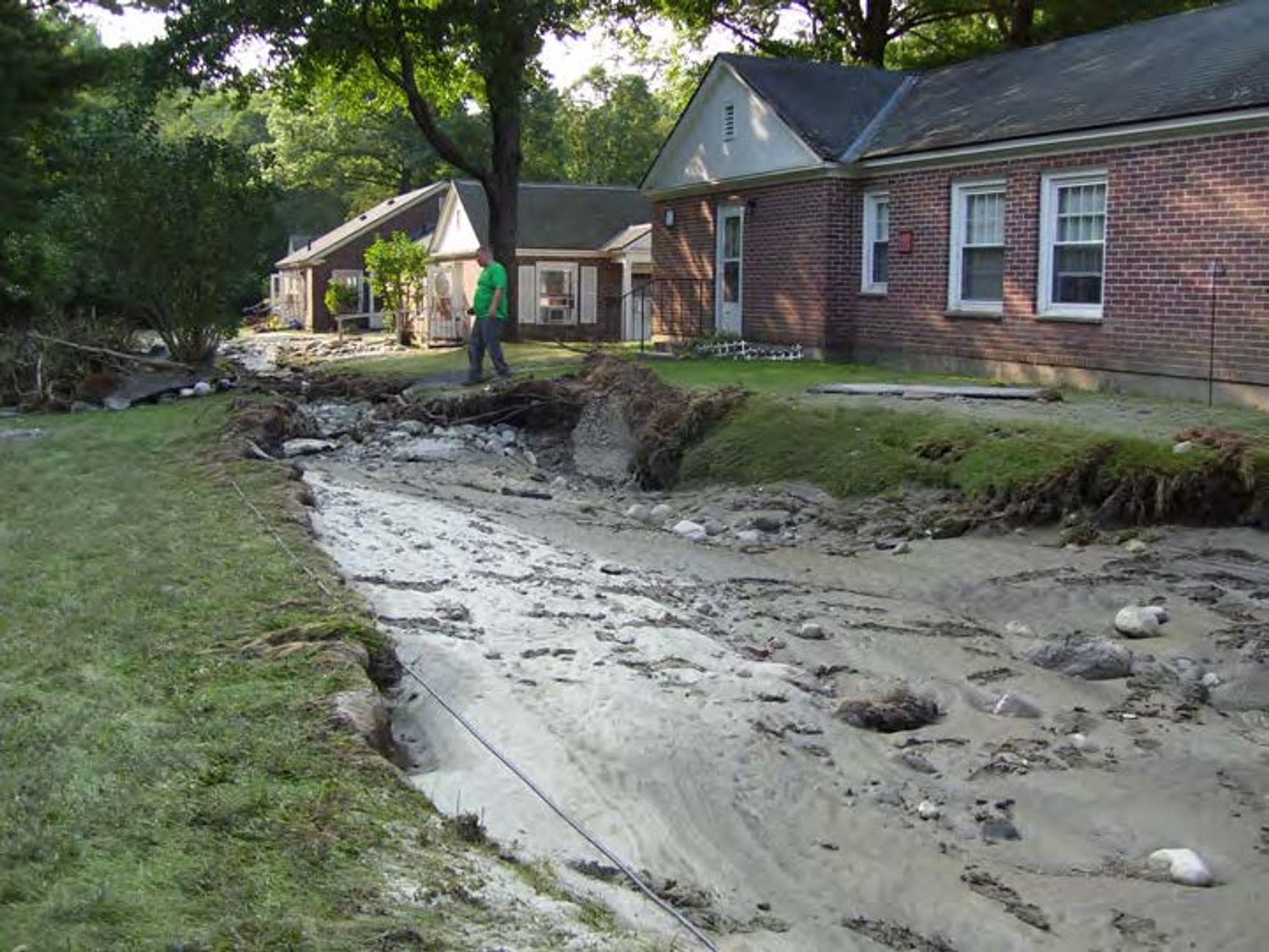
After Irene, extensive erosion- and inundation-related repairs were necessary to make the property safer, but it would never fully reduce the threat of flooding. Following Irene, in 2012 SLR identified a floodplain restoration concept that could reduce flooding. The housing development owner Brattleboro Housing Partnerships (BHP), with the support of Vermont Emergency Management and the Town, worked to secure FEMA Pre-Disaster Mitigation and Vermont Community Development funding to remove 11 of the 16 buildings, create new housing for residents out of the flood zone, and develop a flood-safe open space that allowed the river to expand during heavy rains. The project proposed to be beneficial for the community as a whole, removing people from flood risk, relocating critical city infrastructure out of the floodplain, improve resiliency of road crossings, reducing flood elevations for nearby and remaining structures and would restore the ecosystem to be able to facilitate flooding with a 5-acre riparian forest.
Solution
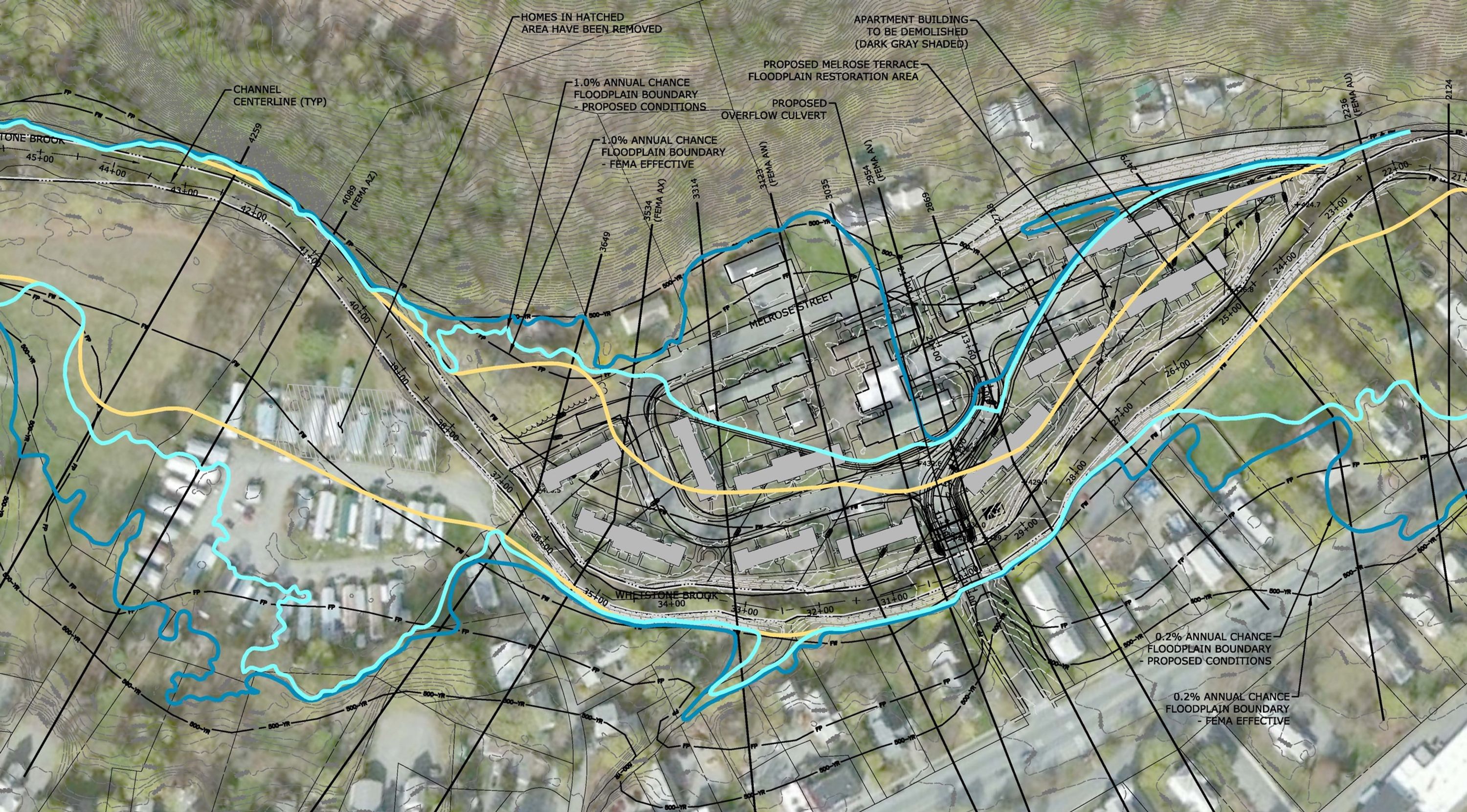
SLR worked with project partners to develop the project and support funding applications. Advanced hydraulic modeling was used to simulate observed flood depths in the special cases where floodwaters were trapped behind buildings, with the deepest flooding located farthest from the normal river channel.
Multiple alternatives were explored, and a FEMA Benefit-Cost Analysis was completed in support of the project elements selected for implementation, achieving an Benefit-Cost Ratio of 2.5. Extensive project review was completed by FEMA, including a CLOMR and LOMR to update the floodplain mapping.
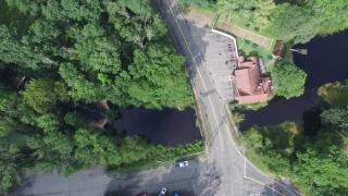
Melrose Terrace Floodplain Restoration
Relocating and improving community infrastructure
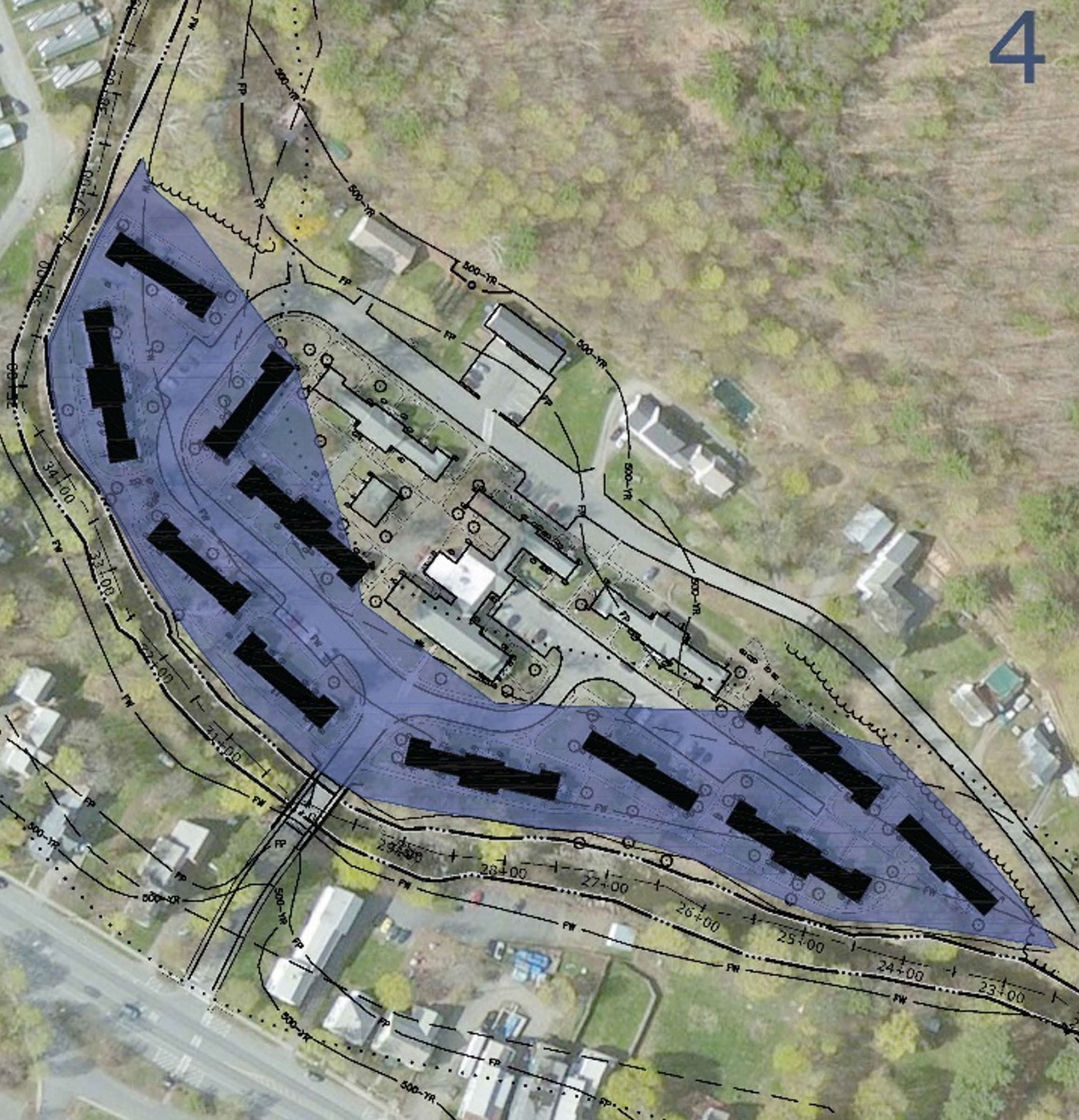
A major project component was removal of 11 residential buildings from the most flood prone areas. As part of SLR’s design significant infrastructure improvements were made to reduce the risk of flood damage. Town-owned infrastructure, including road connections, drinking water mains, and sewer mains were all redesigned to relocate as much as possible out of the vulnerable floodplain areas. The water and sewer pipe networks were relocated behind rock-reinforced slopes. A roadway, George Miller Drive, which previously circled around the Melrose Terrace property, was rerouted to remove the road from the floodplain.
Using modelling and data as a guide, SLR also identified that the George Miller Drive bridge and adjoining road embankments were also a failure point along the floodplain that unintentionally raised floodwaters within the site and upstream neighborhoods. The design increases the hydraulic capacity at the road crossing, with an innovative approach including the installation of a large overflow culvert and lowering the road surface to provide controlled overtopping during storms over 25-year recurrence.
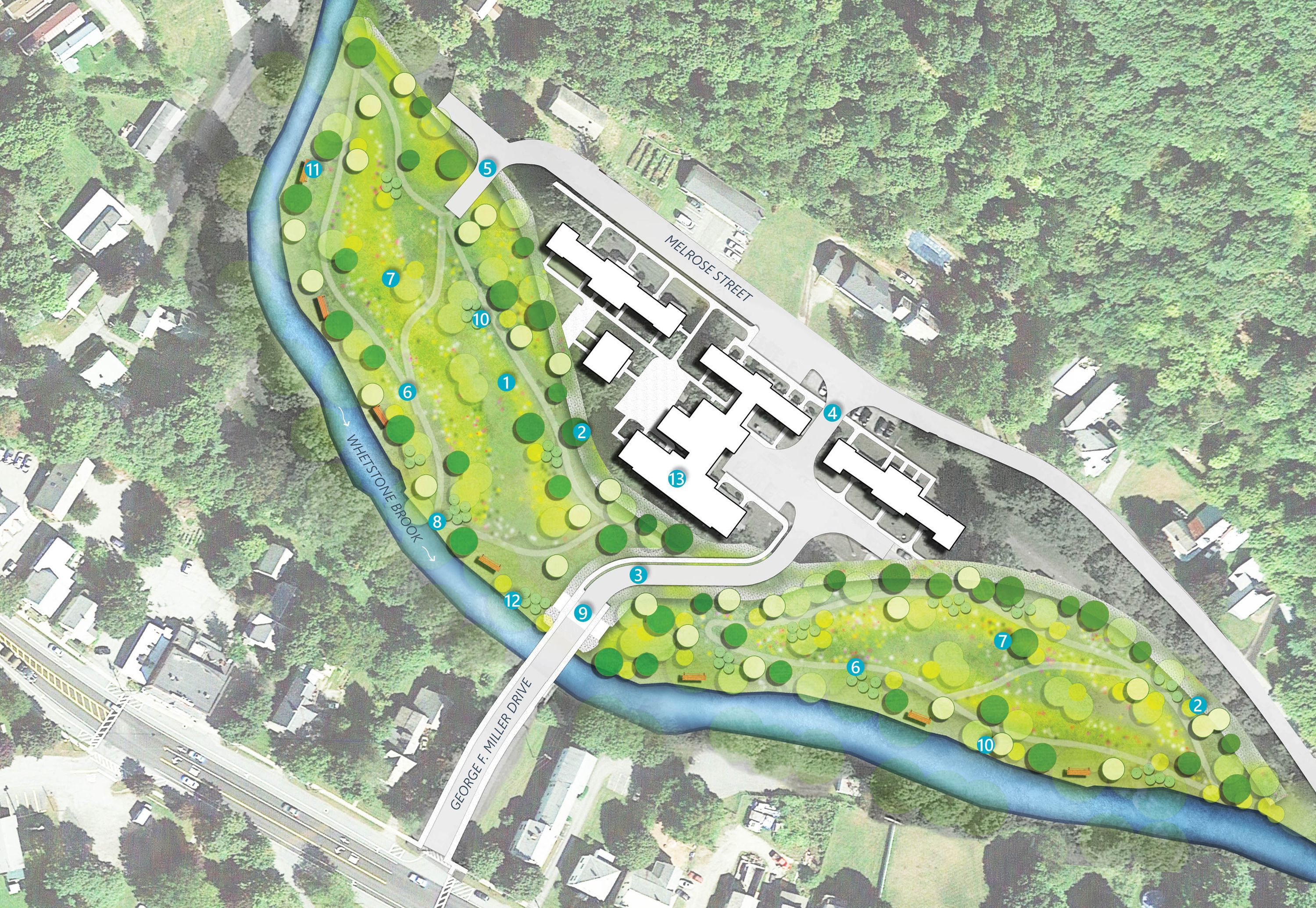
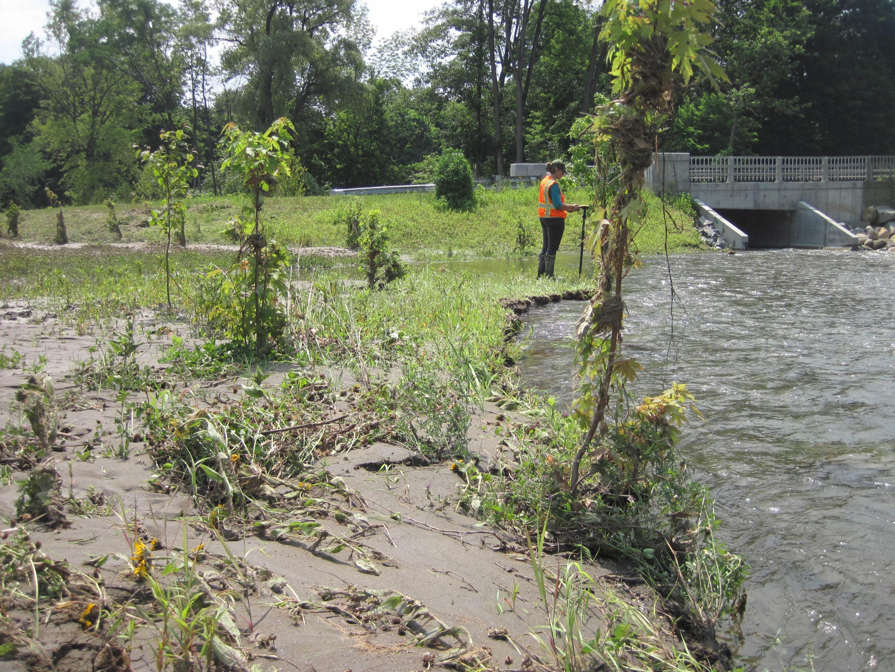
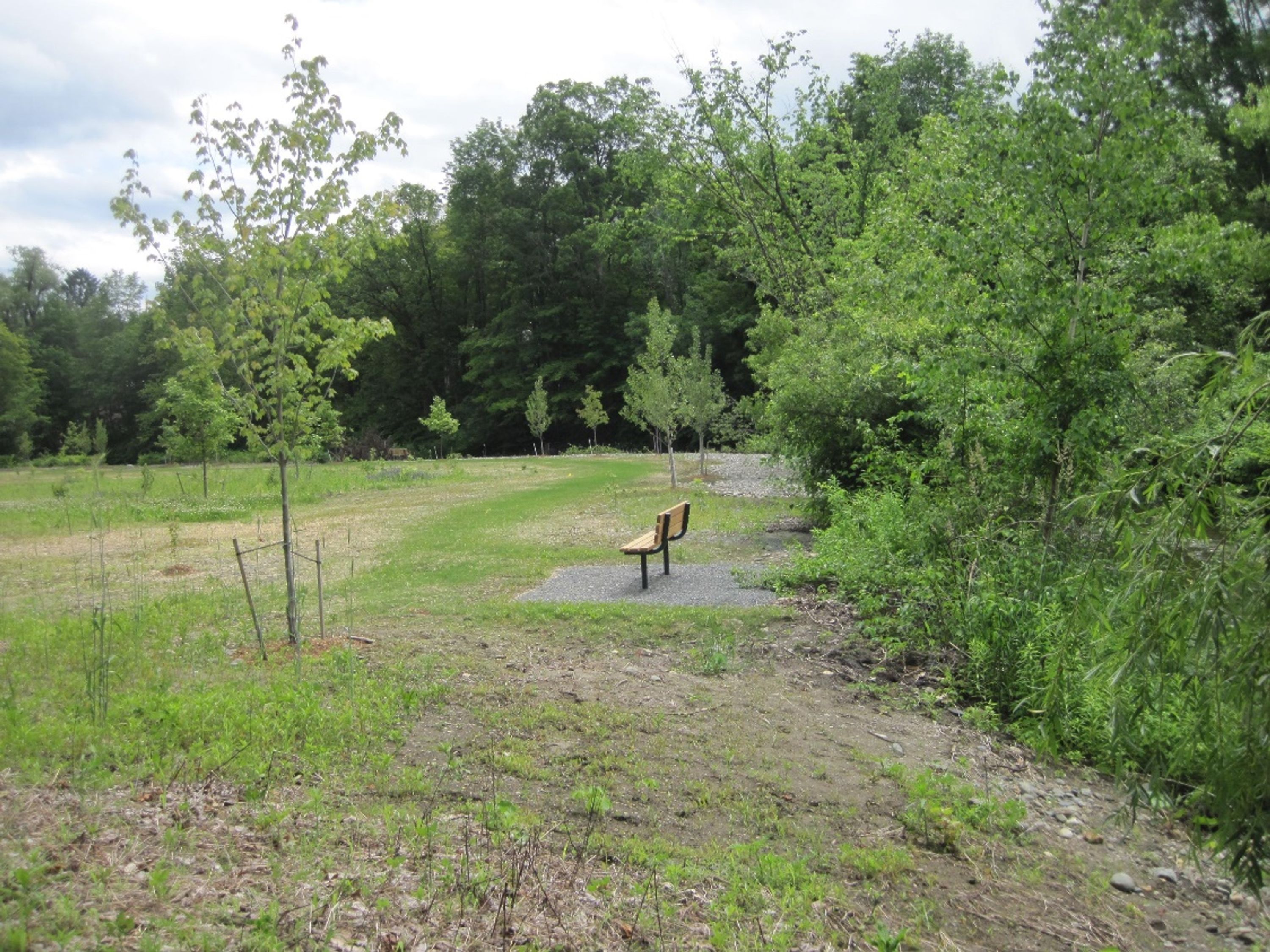
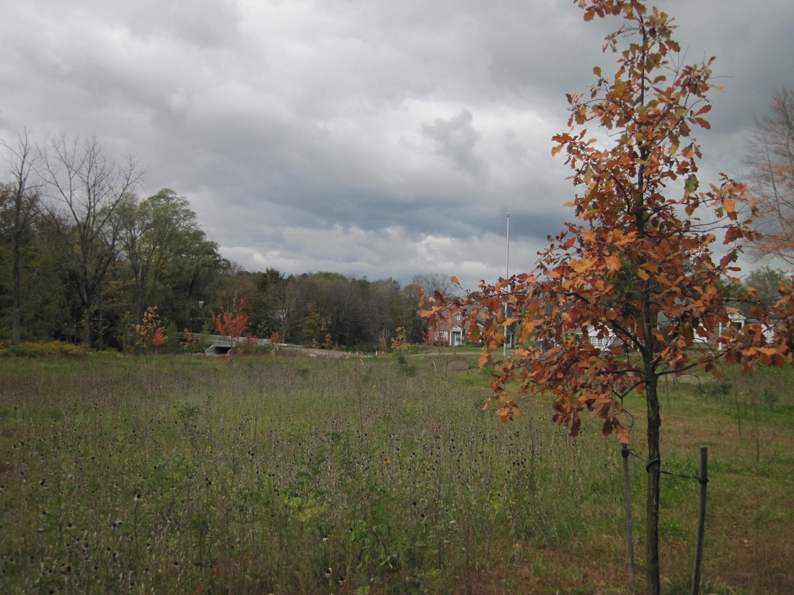
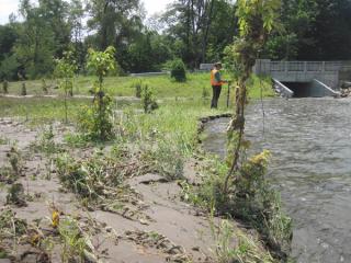
Lowering the land and planting a riparian forest
After major infrastructure was handled, SLR set to work on developing a riparian area in the floodplain capable of supporting high flooding events like Tropical Storm Irene. Over 5 acres, 28,000 cubic yards of fill was removed from the location to lower the land an average of 5 feet. A riparian forest was then planted with a combination of native grasses, flowers, shrubs, and trees which naturally support the prevention of erosion.
Impact
The project was completed in fall 2022, with a spring 2023 punch list related to final stabilization and revegetation.
The floodplain restoration has proven its worth during recent flood events in December 2022 and July 2023. As planned, the new floodplain has slowed and stored flood waters, collected sediment and debris that may have blocked downstream bridges, and reduced flooding in the area.

The Town testified at the statehouse following 2023 flooding that Melrose Terrace and other future floodplain restoration projects are key strategies that the Town and partners are taking as “a holistic approach to hazard reduction; we are focusing on social equity, preservation of natural, cultural, and historic resources, and community resilience.”
Moving people, especially vulnerable populations, out of flood risk is an important step toward equity in our communities. The project eliminated cost and anxiety related to the evacuation of residents of the former 80 housing units, which would have occurred four times in 2023 alone.
Post-construction success
Whetstone Brook is naturalizing at the site after being channelized and constricted between walls and the bridge for almost 60 years.
The floodplain restoration of Melrose Terrace is being used as an example of forward-thinking flood mitigation in Vermont, helping the state and communities understand that floodplain restoration benefits the community at large from hardships that may come from future flooding.
“This [FEMA Hazard Mitigation] funding will support buyouts and floodplain restoration projects to better protect homes and communities, like we did with Melrose Terrace in West Brattleboro...”
Governor Phil Scott, Fiscal Year 2025 Budget Address