Data centre backup power may be temporary, but its air quality impacts aren’t
by Ben Turner
View post
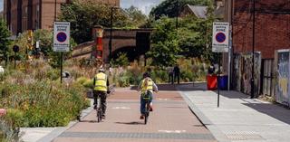
The way we plan for movement continues to change. The UK government’s August 2026 National Planning Policy Framework (NPPF) [1] further embeds the move away from traffic-focused ‘predict & provide’ towards a clear sequence:
Vision → accessibility and safety → movement strategy → sustainable travel infrastructure → assessment → mitigation → delivery.
This matters for developments of all types and scales. Transport inputs are no longer simply part of the evidence prepared to test a development proposal. Increasingly, transport helps to shape the proposition from the outset.
Movement strategies help answer some fundamental questions: whether a site is genuinely sustainable, what scale and form of development it can support, what infrastructure is needed, and how that infrastructure can realistically be delivered. The implications are relevant to all developments, particularly:
Importantly, vision-led planning does not mean less technical evidence. It means asking different questions from the outset and providing robust evidence to inform the strategy:
These are questions for the first conversation about a site – before key assumptions about its scale, form, and movement patterns become fixed. The answers should then flow through the masterplan, movement strategy, infrastructure strategy and, ultimately, the supporting transport evidence.
At SLR, this is closely aligned with the way we approach vision-led planning. We bring transport, land use, infrastructure, and place-making together early, to influence strategy and unlock opportunities while retaining the technical rigour needed to test proposals, demonstrate policy compliance, and support delivery. That means combining vision-led techniques and approaches, including our data-driven FLINT vision-led planning tool, [2] with wider quantitative and qualitative evidence needed to understand accessibility, test options, and develop robust, deliverable strategies.
The policy framework may have changed, but the bigger opportunity is to rethink when transport planning begins, what it informs, and the role it can play in creating successful places. If you're considering what the NPPF 2026 changes could mean for a strategic site, site promotion, a station-led opportunity, or a live or emerging planning application, we'd love to have a conversation.