
Modern Slavery in Private Markets: From statements to meeting supply chain management expectations
by Dean Alborough
View post
Geomorphology is the study of landforms and the processes that shape them. Although scientific, geomorphology offers numerous practical insights that shape how we interact with the land. Its role in the success of projects - from climate resilience to infrastructure planning - is both strategic and transformative. This blog highlights four geomorphology projects across Canada: designing a naturalized discharge channel in northern Quebec, mapping landslide hazard zones in Williams Lake, and routing a transmission line through sensitive permafrost terrain in Manitoba and Nunavut.
How can treated runoff from a mine site be conveyed to an existing lake that avoids excavation or import of fill, minimizes erosion, maintaining the natural aesthetic, and enhances fish habitat? This is the question our team was tasked with answering at a proposed rare earth mine above the shore of Lac Brisson, in northern Quebec.
Our geomorphologists examined the landforms through aerial photography to identify a flow path for the discharge water that follows natural topography and takes advantage of native cobble-boulder substrates for formation of stable bedforms (pools and riffles). The channel was designed with a smaller, meandering path for normal water flow, set within a wider corridor that can handle storm runoff. The shape and size were based on the morphology of natural stream channels in the area, while also accounting for the altered hydrology, or water flow, introduced by mining operations and closure scenarios. Gravel “borrowed” from nearby eskers is to be placed in key spots within the channel to gradually wash downstream to create and refresh fish spawning beds before water enters the lake.
The City of Williams Lake shows a history of landslides, rockfall and riverine erosion, all of which are affected by climate change. Some of its residents are already impacted by slope instabilities and are looking for safe places to rebuild. To better inform new development within the area, we worked with the municipality to map and characterize geotechnical hazard areas as part of an update to its Official Community Plan.
To map hazard zones around steep slopes and existing landslides, our team of geomorphologists used high-resolution topographic data from airborne LiDAR to detect changes in the landscape. This was combined with geotechnical studies and direct field observations, looking for signs of instability. We mapped hazard zones with future risks in mind, including how climate change and human changes to drainage could worsen existing slope instabilities. To estimate where rocks might fall from low bluffs around the city, we used specialized software (CONEFALL) that models “rockfall shadow zones” from areas identified by geohazard specialists. For the steep escarpments along the Williams Lake River, we determined safe setback distances by analyzing the morphologies (shape and slope) of hollows and time-averaged rates of riverbank erosion of the slope.
The results of this work are now being incorporated into the City’s Official Community Plan. They also contributed to a request to expand the mapping into surroundings of this and other nearby communities facing increased development pressure.

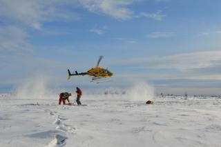
Inuit-owned Nukik Corporation is proposing to deliver hydroelectricity and high-speed Internet to Arctic communities and mines in Nunavut by designing, permitting and constructing a 1,200 km-long transmission line with fibre optic cable between Gillam, Manitoba, and Baker Lake, Nunavut - a project known as the Kivalliq Hydro-Fibre Link (KHFL). This type of linear infrastructure is unprecedented in Nunavut.
The project needed initial routing of a climate-resilient project corridor and contributions to the development of a project proposal for the Nunavut Impact Review Board (NIRB). Both were led by our team of geomorphologists. Using regional-scale mapping of surficial geology and ground ice, we were able to rough out an initial corridor, before defining a more refined route. Following Nukik’s acquisition of high-resolution imagery and LiDAR data for the KHFL corridor, our team prepared 1:20,000-scale mapping of surficial geology and associated permafrost-related features.
Mapping was based on interpretation of the LiDAR data and stereo-imagery, as well as field investigations involving hand-dug test pits, shallow boreholes drilled and sampled with a Talon or ShockAuger, thermistor installation and monitoring, and geophysics surveys employing GPR and ERT techniques. We then characterized and reclassified all distinct map units (polygons) according to their suitability for tower foundations.
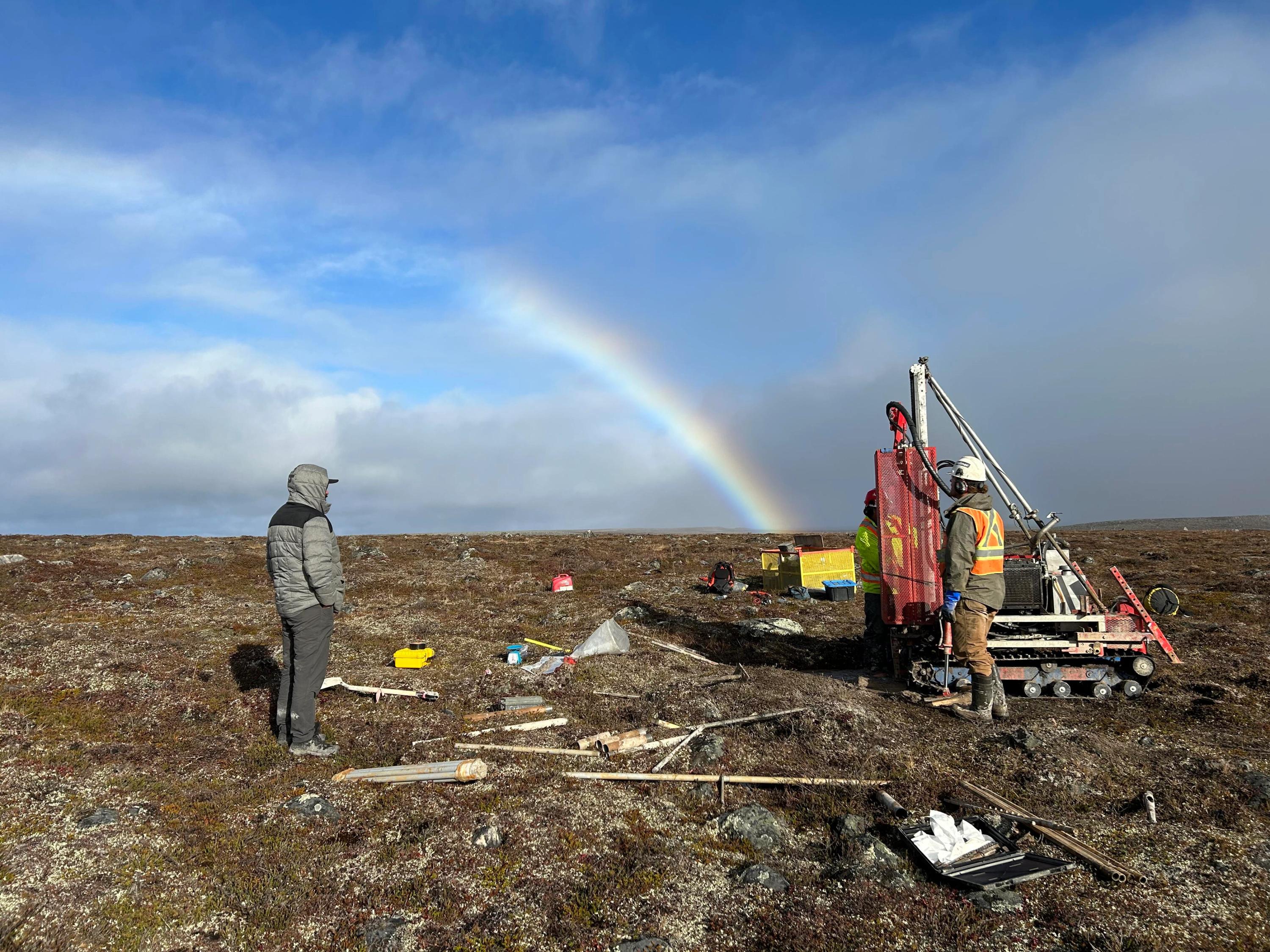
Our team, with support from a thermal modeller at Northern Permafrost Consulting, conducted a preliminary analysis of the implications of climate change on ground conditions along the corridor until the year 2100. We established foundation design concepts to guide future cost estimates by other teams.
The case studies above illustrate how geomorphological expertise is being applied in diverse contexts—from channel restoration to infrastructure planning. By integrating desktop analysis with targeted fieldwork, geomorphologists contribute strategic insights that shape project outcomes early and efficiently. Their ability to interpret landscape evolution, sediment transport, and subsurface conditions adds a layer of understanding that complements and enhances multidisciplinary collaboration. As projects increasingly demand nuanced environmental and geotechnical perspectives, geomorphology continues to play a critical, often underrecognized, role in guiding decisions. To learn more, get in touch.
This Insight is part of our In Focus series. Learn more about the author below.
Geomorphology - Robin McKillop
by Dean Alborough
by Bob Robinson
by Genevieve Sew, Shan Min Tan, James Balik-Meacher